CEMS Activations: Wildfire delineation and grading in East Macedonia and Thrace, Greece

We are delighted to announce that the dedicated efforts of BEYOND/NOA team and its partners (NTUA, IDCOM) under the supervision of JRC CEMS Risk and Recovery team have led to the delivery of reliable and comprehensive fire damage delineation and grading towards the recovery and restoration planning of the affected area at Falakro Mountain in the support of the Hellenic General Secretariat for Civil Protection.
What happened?
In East Macedonia and Thrace, a lightning-induced forest fire at Falakro Mountain sparked an urgent crisis on July 17, 2024. The blaze, which raged until it was fully extinguished on July 27, caused severe damages and had devastating impacts on the local ecosystem including protected natural areas located in the affected areas.
After the official request of the Hellenic Civil Protection Authority our consortium was awarded by the Copernicus Emergency Management Service (#CEMS) - Risk and Recovery Mapping (#RRM) and delivered in time detailed maps and statistics regarding the level of the damage, as input in the decision making process for anticipating restoration actions inside the affected burned areas.
According to the study, the area being damaged is as wide as 1308 ha corresponding to 359.4 ha high/very high severity burned , 687.9 ha medium severity burned and 260 ha low severity burned areas. The damages in regard to the natural landscape refer to approx. 97% forest, 3% agriculture crops and settlements.
Read more about our efforts here:
https://riskandrecovery.emergency.copernicus.eu/EMSN200/
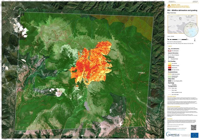
Map 1 depicts the extent of the wildfire at Falakro, Greece and the damage grade of the burned area
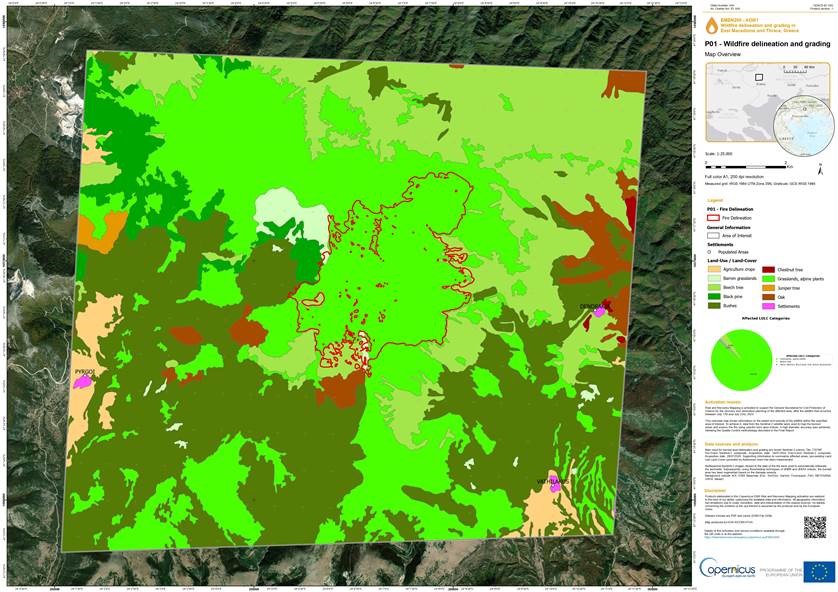
Map 2 depicts the extent of the wildfire at Falakro, Greece and the affected Land Use & Land Cover of the burned area (red boundary) according to CLMS data base