 |
GEO_CRADLE: Coordinating and Integrating State-of-the-Art Earth Observation Activities in the H2020-SC5-2015, GA : Νο 690133 2016-2019 2.910.800 EUR |
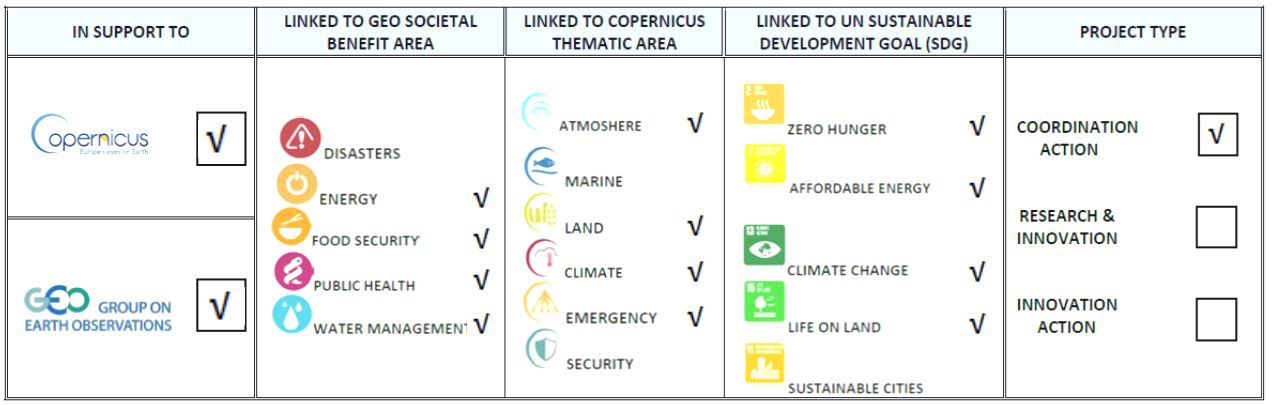
GEO-CRADLE is a Coordination and Support Action established for providing support to the Intergovernmental Organization GEO (Group on Earth Observations) and the Program for Global Monitoring for the Environment and Security Copernicus. GEO-CRADLE is also a synergetic action that establishes a network of stakeholders across the entire value added chain in Earth Observation (research, service providers, data providers, decision makers)and builds on platforms for the integration and dissemination of EO data and know-how across the regions of N. Africa, Middle East, and the Balkans (NAMEBA - also called as RoI-Region of Interest). For the time being GEO-CRADLE coordinates Earth Observation activities in 21 countries over NAMEBA. It supports practices of research organizations, public authorities, and private sector entities for accessing to and exploiting the satellite data of Copernicus and Copernicus contributing missions, as well as accessing to open and high quality in-situ platforms, data portals and arithmetic modelling capacities linking with the more advanced European research and industry facilities. The program establishes links with International Organizations and International Funding Mechanisms and creates roadmaps for actions towards using the Earth Observation technology and data in support to the four thematic priority areas of the project that are Adaptation to Climate Change, Improved Food Security and Water Extreme Management, Exploitation of Renewable Energy Resources, and Access to Raw Material in the regions of RoI. GEO-CRADLE as such has been recognized as Community Activity of GEO, and so far its outcomes have been used as fundamental components in the definition and development of following European Union flagship initiatives and big projects in the domain such as EuroGEOSS and NextGEOSS.
In the course of its lifetime the project has succeeded to:
- • Promote the uptake of EO services and data in response to regional needs.
- • Support the effective integration of existing Earth Observation Capacities in the RoI.
- • Facilitate the networking and engagement of the EO stakeholders in the RoI.
- • Build trust and capacity among the actors, and enhance their participation in and contribution to the implementation of GEOSS and Copernicus in the RoI.
- Propose a roadmap (http://geocradle.eu/en/regional-capacities/roadmap/) for the implementation of GEO, GEOSS and Copernicus in the RoI.
The results of the project so far can be summarized as follows:
- Extensive mapping and assessment for the first time over the entire ROI of the EO capacities and state-of-the-art. Documentation of the identified capacities in a well-structured and easily searchable data base (http://geocradle.eu/en/tools/networking-platform/). Specific focus has been placed on capturing the current state-of-play with regards to monitoring infrastructure (84 usable in-situ networks and 25 space data acquisition facilities), skills, national policies, involvement in international projects, etc. This has allowed to construct an up-to-date picture of the current capacities and identify potential gaps against user needs.
- A detailed collection of needs from more than 80 end users over the NAMEBA has been completed with the aim to steer the integration of existing EO capacities towards addressing those needs. This was done systematically through dedicated interviews and exchanges in numerous outreach activities and organization of tens of regional meetings and workshops. As outcome of this process a regional action plan was produced in which about 40 priority proposals were initially included, and from which after consolidation a number of 8 common regional actions in relation to service delivery and capacity building challenges were promoted.
- Engagement and creation for the first time in the RoI a network of EO stakeholders (scientists, service/data providers, end-users, governmental organizations, and decision makers), which facilitates the exchange of know-how and partnering between the regional actors and the EU EO interlocutors. The project operates a networking platform (http://geocradle.eu/en/tools/networking-platform/), in which 262 profiles of EO actors active in the RoI are included, allowing for interested parties to seek potential partners for cooperation on EO activities. GEO has expressed strong interest in using the networking platform for publishing profiles of stakeholders engaged in the AfriGEOSS initiative as well.
- Design and launch of the Regional Data Hub (RDH) (http://datahub.geocradle.eu/) , a prototype and innovative infrastructure which exploits the advanced IT tools of GCI DAB APIs and DKAN, allowing the ease and effective access to the GCI platform and any other regional portal and dataset. It fosters the open and free data exchange and expands the visibility of the GCI and other existing portals in the RoI among the EOI actors. According to GEO, the RDH represents an example of a data hub which needs to be replicated from functional and technological point of view in other relevant EU GEO related projects. Today RDH facilitate free access to millions of geospatial data sets over the three regions.
- Conduct dedicated liaison activities for establishing relationships with high-level stakeholders including inter alia GEO (Secretariat, GEO-GLAM, GMES and Africa, AfriAlliance, ConnectinGEO, AfriGEOSS, etc.), Copernicus (DG GROW), DG RTD and ESA. This has yielded substantial momentum for the project, exemplified through the invited participation of project representatives in important fora (e.g. GEO Plenary, EU EO companies’ workshop, etc.). Through targeted communication activities, and numerous events organized or attended, the project has contributed significantly to the build-up of strong momentum around its activities, reached out a large number of actors, and has disseminated the goals of GEO and Copernicus in the RoI.
- “Export” Copernicus: Through a series of activities GEO-CRADLE has raised awareness on Copernicus in the RoI, and among EU service providers. In addition, the Copernicus Core products are integrated in the pilot activities described hereinafter. Awareness-raising activities have been undertaken with the dissemination of EC Copernicus materials.
- Launch 4 activities after followed a rigorous gap analysis and identification of regional priorities as described previously. Thus, the selected activities will pave the way for the development of sustainable EO services in the region in the 4 thematic priorities of the projects, making use of infrastructure integration and collaboration between partners.
- Scientific footprint of the project: The pilot studies have resulted in various innovative research and innovation results and tools and a number of 7 scientific publications have been already created and published in 5 journals and relevant scientific conferences.
- The pilot-feasibility studies of the project have returned significant socio-economic benefits to the involved countries and societies over the RoI as:
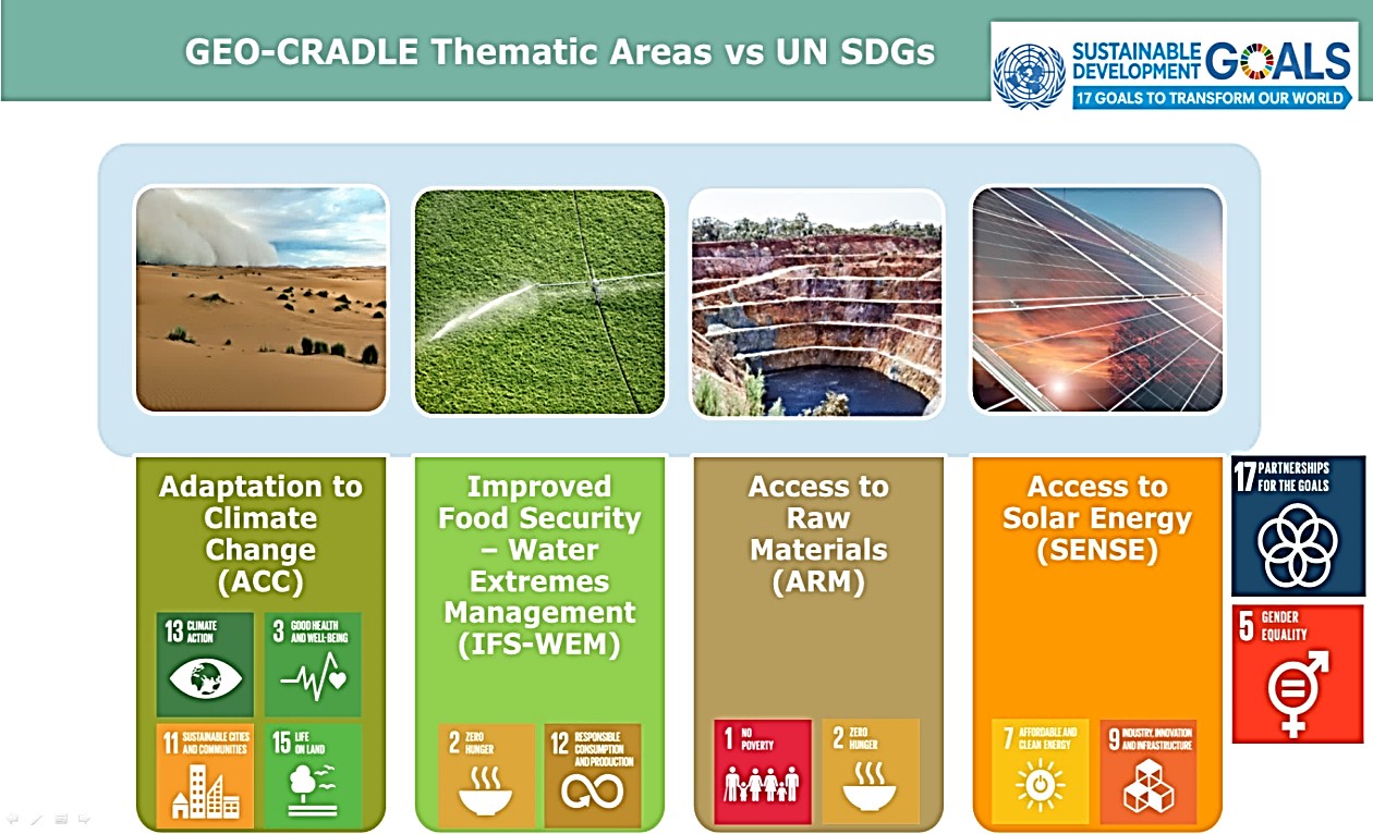
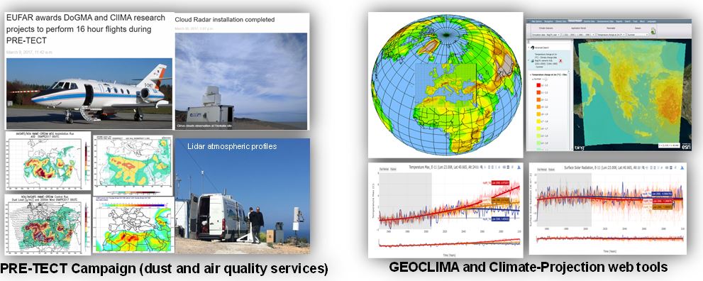
- Adaptation to Climate Change (ACC) pilot: The identification of user needs in the RoI is specifically addressed for 4 sub-regions: 1. FYROM and Albania, 2. Serbia, Romania, Bulgaria, 3. Greece, Cyprus and Turkey and 4. Morocco, Tunisia, Egypt, Israel. Climate change related needs were identified for these regions. These needs have been further classified into the following thematic areas: air quality, meteorology and natural risks, namely: 1. desert dust services, 2. regional climate change services, 3. air quality services, all aiming to pave the ground for the holistic monitoring and forecasting of region-specific atmospheric components, ECVs and hazards, in line with the standards and vision of GEOSS and Copernicus. Specific cases of End Users currently showing strong interest on the promoted services have been aviation authorities, and environmental and civil protection institutions and agencies in the RoI. The services are provided for free to any user through dedicated web services of GEI-CRADLE portal: http://datahub.geocradle.eu/dataset/dear-clima, http://datahub.geocradle.eu/dataset/acc-dust.
- Improved Food Security – Water Extremes Management (IFS-WEM) pilot: 1) Transfer of know-how between the involved partners (from EO advanced to less advanced countries) on the application of soil spectroscopy in the RoI. Collection of soil samples and building a standardized Soil Spectral Library (SSL) in the RoI to be served as input to machine learning algorithms which create models correlating the spectra with the soil properties to be applied to Sentinel-2 satellite data to create soil thematic maps. SSL has been completed in Greece, Cyprus and Israel, it is ongoing in Turkey and Serbia, and currently pending in Albania and Bulgaria. 2) Development of an adapted and enhanced version of the WebGIS platform myDEWETRA to assist in improving the accessibility and comparability of flood and drought risk information and data at regional and national level in the RoI, taking as input data of the RoI as well as the soil maps derived from state-of-the-art techniques using Sentinel-2 satellite data in conjunction with the soil spectral data. The services developed are freely available through web service facility:http://geocradle.eu/en/regional-capacities/feasibility-studies/ (GEO-CRADLE portal).
- Access to Raw Materials (ARM): Launch of two types of pilot projects: monitoring of illegal quarrying and improved monitoring in abandoned mines. Elaboration of EO methodologies relying on the use of Sentinel (Copernicus) satellite data, for better management of the mining and post-mining areas and reduction of their impact on the surrounding areas, with a universal character, applicable for other RoI as well. Intense effort to find a third pilot project, preferably in North Africa or Middle East. The services are freely delivered through a web service application available in the GEO-CRADLE portal: http://geocradle.eu/en/regional-capacities/feasibility-studies/.
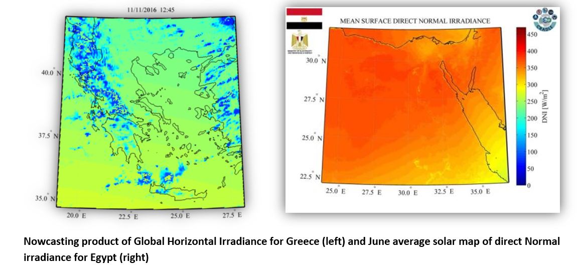
- Renewable Energy Resources (SENSE): The SENSE pilot builds upon the regional energy needs, and takes advantage of the current satellite data availability, efficient envision of new but crucial model inputs and state-of-the-art real time solar energy calculating system capabilities for generating reliable, high resolution solar Atlases and broader climatology studies for the Region of Interest, while it engraves strategy methods of how to integrate such a solar energy nowcasting system into a wider GEOSS driven system in the international scale with multifarious collaborations and carefully selected end-users. SENSE succeeded in stimulating the interest of relevant energy stakeholders and decision makers like Ministries of Electricity and Renewable Energies (Egypt), Electric Power Transmission Operators (Greece) and Solar Energy investors from the private sector (Attica Group). The services are freely delivered through web service applications available in the GEO-CRADLE portal and Regional Data Hub (http://datahub.geocradle.eu/dataset/solar-atlas).