 |
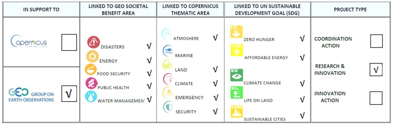
NextGEOSS: Next Generation GEOSS for Business & Innovation H2020 SC5-20-2016 2016-2019, GA : Νο 730329 420.000 EUR (NOA Budget)/10.000.000 EUR (Overall Budget) |
Project relying on the infrastructure and research developed in the BEYOND Center of Excellence and the GEO-CRADLE Coordination and Support Action.
The project NextGEOSS (Global Earth Observation System of Systems) develops the next generation of the GEOSS Earth Observation (EO) initiative, enabling global access to EO data, prototype and higher TRL innovative services using a single platform. The project extends the EU heritage in research and commercial use of earth observation (EO) data, encourages and stimulates the data exploitation by businesses, engages stakeholders and end-users (through the GEO-CRADLE Portal), delivers technological developments and promotes the use of GEOSS to support the creation and use of EO activities in research and commercial sectors.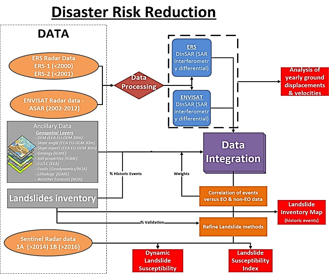 NextGEOSS identifies training needs and encourages the wider user-engagement with EO data and its commercial potential. In the framework of NextGEOSS the role of NOA is critical. It strengthens the access to Earth Observation at regional level so that it becomes easier to harvest, consolidate and exploit those data at global level using the NOA facilities for data acquisition, and the operation of the various satellite data hubs, namely the Hellenic Mirror Site. Supports overcoming the fragmentation of the European landscape of existing public and private Earth Observation data infrastructures and maximize their combined exploitation by building upon the concepts of the GEO-CRADLE Regional Data Hub and GEOSS Common Infrastructure (GCI) platform. The BEYOND/NOA research team is also developing a prototype Multihazard Enhanced Risk Assessment Platform based on the statistical analysis of long time series of data accessible through the NextGEOSS Data Hub. The emphasis is on the development of state-of-the-art models that meet advanced requirements of users in accessing to high accuracy data and information products to deal with geohazards such as landslides resulted from heavy rains, and earthquake events. The workflow is demonstrated on models developed in the context of the Copernicus Emergency Management Service (EMS) and the BEYOND Center of Excellence, and use as input information the ground deformation velocities derived from the interferometric processing of multi-temporal Synthetic Aperture Radar (SAR) data (ERS, ENVISAT, Sentinel-1), landslides events repositories and inventory databases provided by our partner IGME (Institute of Geology & Mineral Exploration), and other non EO data such as DEM, Slope, Aspect, Geology, Soil, Lithology, LU/LC, Faults, precipitation, Soil Moisture, Seismicity, Drainage density. The outcomes of this research study provides: Analysis of yearly ground displacements (velocities); Landslide Susceptibility based on historical data analysis; Updated Landslide Inventory Maps based on the systematic processing of SAR imagery (e.g. Sentinel-1, or other older and freely available HR SAR data).